Sunbelt Rentals Is the First Global Equipment Rental Provider of Skydio X10 Drones
Sunbelt Rentals has added Skydio’s X10 drone to its equipment catalog, becoming the first global equipment rental provider to do so. The rollout began September 15, 2025, and is now available across Sunbelt’s nationwide network. The agreement, supported by technology deployment firm Velociti, puts advanced drone technology in reach for contractors who may not want to purchase outright. From the press release:
“The X10’s best-in-class AI flight and 360 obstacle avoidance, advanced imaging and sensors, as well as ease of use, make it a perfect addition to our rental portfolio. Our customers now have a rental option giving them the freedom to scale drone usage as project demands evolve,” said Matt DiDonato, director of Fleet Product Development at Sunbelt Rentals.
Skydio Background
Skydio is one of the largest U.S. drone manufacturers with a specialty in autonomous flight. Founded in 2014, the company designs and assembles its products in California with a focus on data security and NDAA compliance. Its portfolio covers drones, docking stations, software platforms and services aimed at enterprise and government users. The X10 is Skydio’s flagship enterprise drone, designed for a mix of ruggedness, autonomy and imaging. Compact in size but rich in features, it offers flight times of up to 40 minutes, weather protection and obstacle avoidance that covers every angle. The system was created to operate in cluttered, real-world environments without extensive pilot skill.
Inside the X10
The Skydio X10 can deploy in under 40 seconds and fly at speeds up to 45 mph. Its IP55 rating gives it resistance to dust and rain, making it suitable for construction sites, fields and utilities. What sets the X10 apart is its modular sensor payloads. Options include narrow and wide visual cameras, a long-range telephoto lens and a radiometric thermal camera built around a Teledyne FLIR Boson+ sensor. This combination lets operators capture fine details in concrete cracks, read license plates from hundreds of feet away or detect heat variations in transformers and panels. Precision mapping is also possible with RTK/PPK modules that tie drone imagery to survey coordinates.
Operators can expand the drone with attachments like spotlights, speakers and even parachutes. Skydio also offers the Dock system, which allows drones to live on site and fly scheduled or on-demand missions remotely. From the press release:
“We’re excited to team up with Sunbelt Rentals to offer our mutual customers flexibility and choice when it comes to how they access Skydio’s cutting-edge drone technology,” said Callan Carpenter, Skydio’s chief revenue officer, “Sunbelt Rentals’ reputation and reach enable it to serve customers nationwide and across all industries, helping these organizations gain access to Skydio’s products when and where they need it.”
Key X10 highlights:
- Up to 40 minutes of flight time
- 45 mph maximum speed
- Under 40 seconds to deploy
- IP55 dust and water rating
How Contractors Could Use It
For construction, drones can document progress, generate 3D site models and measure earthwork volumes. Instead of waiting for survey crews, contractors can track cut-and-fill quantities in near real time. Drones also provide a record of rebar placement, utility runs and finished work before it’s buried. Landscape contractors can use drones to survey sites before bidding, identify drainage challenges or verify hardscape placement. Finished imagery can be turned over to owners as a visual as-built record.
In agriculture, drones extend beyond crop photography. They can pinpoint irrigation failures, check fencing or evaluate livestock watering stations without long truck drives. Foresters can monitor fuel loads and access points in remote acreage. Utilities benefit from aerial inspections as well. Instead of rolling a truck, operators can scan distribution lines, substations and renewable installations. Thermal imagery highlights hot spots and failing components before they cause outages. After storms, drones provide fast assessments that guide where to send repair crews.
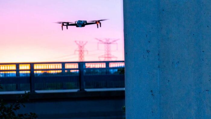
Public works departments can also use the X10 to inspect bridges, levees and flood defenses. Check out that video above. High-resolution cameras capture cracks, spalling and corrosion without lane closures or scaffolding.
Industries that benefit most from drones:
- Construction and site development
- Landscaping and grounds management
- Agriculture and forestry
- Utilities and energy
- Public works and infrastructure
Practical Adoption
Sunbelt’s rental option lowers the barrier for contractors who want to test drones without large capital outlay. A rental model fits short-term projects, seasonal spikes or pilot programs. Velociti supports deployment and management for companies that want to scale programs across multiple sites. Crews still need to follow FAA Part 107 regulations and local airspace rules. But Skydio designed the X10 to be approachable, with training measured in hours rather than weeks. With repeatable flight paths and consistent data capture, even small teams can build reliable workflows.
The Takeaway
By adding Skydio’s X10, Sunbelt Rentals has given contractors, landscapers and utilities a new way to gather site intelligence. The drone combines speed, ruggedness and detailed imaging with the flexibility of a rental program. For many pros, this could be the first step in building aerial data into everyday operations.
Keith Gribbins is publisher of Compact Equipment.
Find out more about some of the largest skid steers on the market.