WOC Coverage: Leica iCON Looks to Revolutionize Construction Telematics
Leica Geoystems makes an impressive range of surveying and geomatics products — construction lasers, GPS systems, locators, mobile mapping systems, theodolites and so much more. Now the company is bringing all of its technologies together under a pioneering portfolio of tailor-made positioning and measuring solutions for construction professionals called iCON.
Leica iCON looks to change the way construction tasks are performed on site by offering new technology that significantly optimizes construction workflow efficiency. iCON mad its debut appearance at the World of Concrete show. Of course Leica iCON is more than a new product line and a software package. It enables contractors to enhance their performance and increase their profitability through perfecting the entire construction workflow. As an umbrella for the entire Leica Geosystems Construction program, iCON includes:
1. iCONstruct — Tailor-made hardware and software solutions for positioning and measuring tasks on site
2. iCONtrol — Providing perfect communication between construction personnel on site and a comprehensive portfolio of machine control solutions
3. iCONsult — An extensive support network, with clear guidance on intelligent CONstruction benefits to grow contractors businesses
4. iCONnect — Connects the system to a superior network. Wireless data transfer, easy, fast and secure
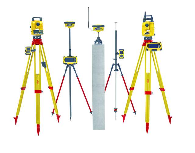
Leica iCON offers complete and tailored positioning solutions for the building construction segment and the civil engineering segment. Leica Geosystems plans to expand the iCON solutions to further specific construction trade segments in the near future, but right now it’s got two main segments it’s promoting.
1. Leica iCON Build — Custom-built Solutions for Building Construction
Leica iCON build is part of the unique iCONstruct toolbox, enabling customers to carry out all positioning related tasks with just one software solution, improving speed, performance and accuracy. Whether they need to precisely layout formwork with total stations or roughly mark a building pit using GPS, iCON build is developed to seamlessly integrate with any of the iCONstruct sensors and controllers. Unique features and graphical support within iCON build allow users to carry out specific tasks on site in an easier, straightforward way.
2. Leica iCON Site — Custom-built Solutions for Site Construction
Leica iCON site is also part of the iCONstruct toolbox focusing on the engineering and infrastructure segment. Just as iCON build, it features a smart graphical interface, is easy to use and the operating workflows are designed to suit the way operators work. iCON site offers perfect solutions for all positioning tasks needed on civil engineering projects, from data collection on site through stake out tasks and grade checks, cut & fill controls to as-built verifications. With iCON site’s smart, custom-built applications most of the measurements on site can be carried out easily and efficiently by the foreman, without needing to wait for a surveyor or engineer.
For more information about Leica iCON please visit www.leica-geosystems.com/icon or watch the teaser video below.
Comments are closed here.